
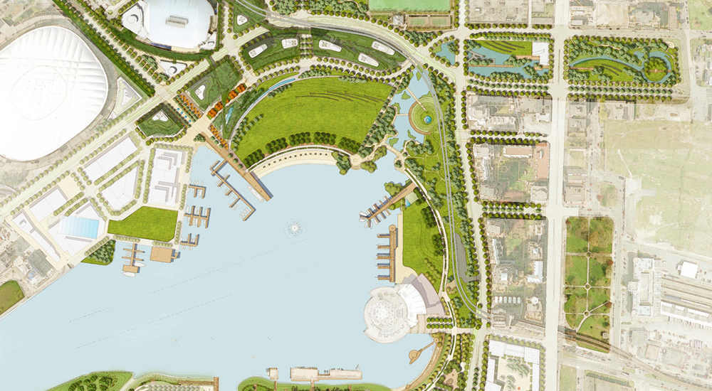
re:CONNECT : Visualizing the Viaducts / re:CONNECT : Visualiser les viaducs
2011
Vancouver, British Columbia, Canada- Planning
- Districts
- Development area
Visualizing the Viaducts
This component of the competition seeks conceptual design ideas for the land currently occupied by the Georgia and Dunsmuir Viaducts or for the structures. All ideas are encouraged: from full-retention with repurposing of the structures and/or land beneath, to complete removal and replacement with something entirely different, to combinations or other/new alternatives. Submissions will be evaluated on their creativity as well as their ability to move the City towards its goals as outlined in the Competition Principles and the City?s key objectives below.
The Georgia and Dunsmuir viaducts are located between the existing neighbourhoods in Chinatown and International Village, and the newly emerging neighbourhood in Northeast False Creek.
The original Georgia Viaduct was completed in 1915, extending Georgia Street from Strathcona to downtown over the CPR rail yards, industrial facilities and warehouses, providing east-west access to the downtown peninsula. Due to structural problems and ongoing maintenance issues, Vancouver residents voted to replace the Georgia Viaduct in the 1960s with a design that included two structures and continued to pass over the industrial lands of Northeast False Creek below. This design was part of the first phase of a larger freeway network that would have passed through Gastown and Chinatown, along the downtown waterfront, connecting to a third crossing to the North Shore. Thankfully, the viaducts were the only portion of the highway to be constructed, a decision that arguably is the most important city-building choice the city has ever made.
Today the area around the viaducts has a much different context then when they were built. The railway yards have been removed and the industrial areas are no longer present. They still provide an east/west connection from Main Street to the downtown which provides a good connection for bikes and goods movement that is not present otherwise in this area. However, they also create a barrier (either real or perceived) for the area below and for linkages between Chinatown, Gastown and Strathcona to False Creek.
In this competition, the City is interested in exploring a range of structural ideas for the viaducts, the surrounding street network, movement systems, and potential land uses.
The City's key objectives for the Viaducts are to:
- Consider a more coherent street grid and block pattern with significantly improved public realm;
- Consider a variety of land use ideas from intensive civic use (e.g., parks, gathering places, entertainment, cultural, and events facilities) to residential and commercial development;
- Provide a transportation system that allows for people and goods movements reflecting the city's mobility goals and priorities;
(From competition documentation)
This component of the competition seeks conceptual design ideas for the land currently occupied by the Georgia and Dunsmuir Viaducts or for the structures. All ideas are encouraged: from full-retention with repurposing of the structures and/or land beneath, to complete removal and replacement with something entirely different, to combinations or other/new alternatives. Submissions will be evaluated on their creativity as well as their ability to move the City towards its goals as outlined in the Competition Principles and the City?s key objectives below.
The Georgia and Dunsmuir viaducts are located between the existing neighbourhoods in Chinatown and International Village, and the newly emerging neighbourhood in Northeast False Creek.
The original Georgia Viaduct was completed in 1915, extending Georgia Street from Strathcona to downtown over the CPR rail yards, industrial facilities and warehouses, providing east-west access to the downtown peninsula. Due to structural problems and ongoing maintenance issues, Vancouver residents voted to replace the Georgia Viaduct in the 1960s with a design that included two structures and continued to pass over the industrial lands of Northeast False Creek below. This design was part of the first phase of a larger freeway network that would have passed through Gastown and Chinatown, along the downtown waterfront, connecting to a third crossing to the North Shore. Thankfully, the viaducts were the only portion of the highway to be constructed, a decision that arguably is the most important city-building choice the city has ever made.
Today the area around the viaducts has a much different context then when they were built. The railway yards have been removed and the industrial areas are no longer present. They still provide an east/west connection from Main Street to the downtown which provides a good connection for bikes and goods movement that is not present otherwise in this area. However, they also create a barrier (either real or perceived) for the area below and for linkages between Chinatown, Gastown and Strathcona to False Creek.
In this competition, the City is interested in exploring a range of structural ideas for the viaducts, the surrounding street network, movement systems, and potential land uses.
The City's key objectives for the Viaducts are to:
- Consider a more coherent street grid and block pattern with significantly improved public realm;
- Consider a variety of land use ideas from intensive civic use (e.g., parks, gathering places, entertainment, cultural, and events facilities) to residential and commercial development;
- Provide a transportation system that allows for people and goods movements reflecting the city's mobility goals and priorities;
(From competition documentation)